Figuring out where the trail is and where to park requires some research and planning. Here are some valuable resources to use if you plan on hiking the NET. At the time of this writing (March 2017), there is no one single, in-depth source of trail information, so you need to check multiple sources.
 OVERVIEW:
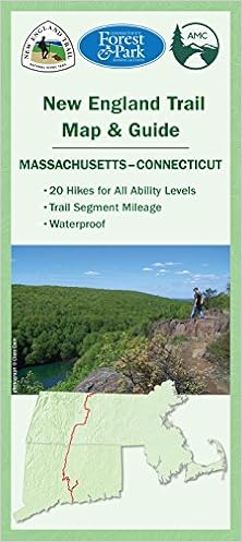
NET Trail Map. This is a nice overview map on heavy-duty treated paper, although I don't think it's detailed enough to rely on out in the field. Better than nothing, though. It's $10.16 at Amazon.com. I used it mostly for planning purposes. It's particularly useful for the long rerouted sections in Massachusetts that are not reflected in the AMC M-M Guidebook.
There is also an online overview map on the NET website, but I found it to be very glitchy if you try to pan.
IN CONNECTICUT:
The Connecticut Forest and Park Association (CFPA) maintains the NET in Connecticut. CFPA maps and descriptions of all 825+ miles of Connecticut Blue-Blazed Trails, including the NET, are in the Connecticut Walk Book, available in bookstores, online, and from CFPA. The 20th edition of the Walk Book is expected in 2017, and several NET reroutes should be reflected in that edition. Be sure to check CFPA's online Trail Notices for any changes to the trail or you may be sorry. In Connecticut, you will be using the trail information for the Menunketuck, Mattabesett, and Metacomet Trails. Trail problems encountered can be reported to CFPA via their website and staff may be available to answer trail questions. See ctwoodlands.org for more information.
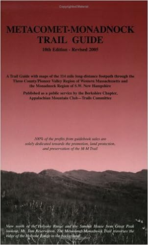
IN MASSACHUSETTS/ NEW HAMPSHIRE:The Appalachian Mountain Club (AMC) maintains the NET in Massachusetts, where it is known as the Metacomet-Monadnack Trail, or M-M Trail. I used the "Metacomet-Monadnack Trail Guide 10th Edition", 2005, although many parts are now obsolete where paranoid land owners kicked the trail off their property. This book includes the M-M Trail in New Hampshire up to the summit o f Mt. Monadnack. Hopefully this will be updated soon. In the meantime, there is a very helpful update posted online HERE. I was not very successful contacting AMC. I had several questions and tried a variety of contact info and never got a response.
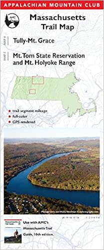 AMC's Massachusetts Trail Map ($9.94 at Amazon.com) is very nicely done and up-to-date as of 2016. This is a good fold-up map with lots of detail and contours to throw in your pack. One side has Mt. Tom and the Holyoke Range while the other side includes the NET from MA 2 in Farley to the Mass border.
GPX File: I found this file after many hours of online searching and don't know who to attribute it to, but I loaded it into my gps receiver as a back-up. There were a few times where it came in very handy when I couldn't figure out where the trail had got to. Many many thanks to the kind soul who shared their data. Thank you thank you thank you. This gpx track shows the NEW route through Quabbin. The gpx route across the Connecticut River isn't what is shown in the guidebook, but unless someone clears out the route in the guidebook, I would use what's on the gps. [Download the gpx file]
CELL PHONE: The NET has great Verizon coverage in most areas. It isn't until you get to the northern part of Massachusetts where it gets spotty, with some valleys not having coverage. The cell phone towers tend to be located on the ridgetops where the trail is.
SHUTTLE RIDES: I used UBER in Southern Massachussetts. It worked great from the CT/Mass line up to the southern Quabbin area. I got a driver in 15 minutes or less every time. Cost was under $10 for the ride plus tip. I haven't tried UBER in Connecticut, but there is probably pretty good service along most of the trail. I tried contacting AMC to see if anyone offers shuttle rides for the northern part of the M-M Trail and never heard back, so I'm not sure about that.
DOGS: Are allowed throughout Connecticut. In Massachusetts, dogs are prohibited on the Quabbin section and in New Hampshire, they are prohibited on Mt. Modadnack. There's no word on what a thru-hiker with a dog is supposed to do.
No comments:
Post a Comment